Roscosmos reveals carnage of Tonga eruption in before & after photos
Russian satellite imagery shows how the Tonga eruption blew an island apart with what NASA states was the force of hundreds of atomic bombs Read Full Article at RT.com
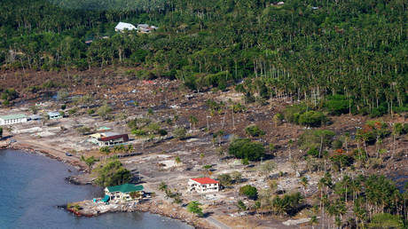
A Russian satellite captured the scale of the devastation from space, showing an island completely obliterated
An image posted online by Russian space agency Roscosmos has revealed the devastation caused by the eruption of the Hunga Tonga-Hunga Haʻapai volcano last week, comparing the border of the two islands before and after the disaster.
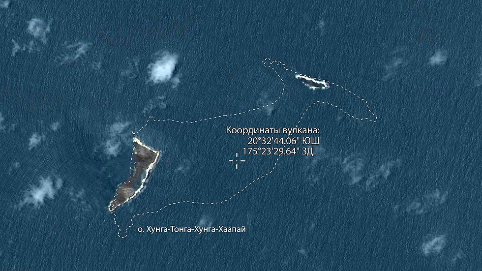
Located 65km (40 miles) south of Tonga’s main island of Tongatapu, Hunga Tonga and Hunga Haʻapai were two separate islands connected by land that formed when a powerful submarine volcano erupted in 2015. However, following last week’s explosive eruption, Roscosmos’ imagery shows only a fraction of both islands remains, with significant chunks of both isles, plus the volcanic land in between, wiped out.
NASA said the eruption, which devastated Tonga and sent tsunami waves as far as California, was “hundreds of times” more powerful than the atomic bomb that flattened Hiroshima in 1945.
READ MORE: ‘Worst ecological disaster’ triggered by Hunga Tonga volcano off Peru coast
“This is a preliminary estimate, but we think the amount of energy released by the eruption was equivalent to somewhere between 4 to 18 megatons of TNT,” the chief scientist at NASA’s Goddard Space Flight Center, Jim Garvin, said in a post on the agency’s website.
Such an explosion is “hundreds of times the equivalent mechanical energy of the Hiroshima nuclear explosion,” NASA stated.